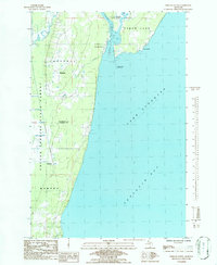
1984 Map of Portage Entry
USGS Topo · Published 1986About this map
Keweenaw Bay meets the southern end of the Keweenaw Peninsula here, where the critical waterway of the Portage River provides a passage toward the copper mining heartlands. The landscape is defined by the entrance to the ship canal, marked by the Portage Entry Lighthouse and the historical Crebassa Latitude Post at Jacobsville. This shoreline was essential for the regional economy, facilitating the movement of vessels between Lake Superior and the industrial hubs near Torch Lake.
Find a feature on this map
17 named features on this map. Tap any name to fly to it.
Don’t see what you’re looking for? This feature index may not catch every label — zoom into the map to look around manually.
Map Details
Editions of this 1984 Portage Entry Map
This is the sole edition of this map. No revisions or reprints were ever made.
Other maps of this area

1915 · Houghton
USGS Topo · 1:62,500

1946 · Chassell
USGS Topo · 1:24,000

1948 · Chassell
USGS Topo · 1:24,000

1954 · Traverse Island
USGS Topo · 1:24,000

1954 · Keweenaw Bay
USGS Topo · 1:62,500

1954 · Point Mills
USGS Topo · 1:24,000

1954 · Pelkie
USGS Topo · 1:62,500

1954 · Houghton
USGS Topo · 1:62,500

1958 · Hancock
USGS Topo · 1:250,000

1958 · Iron River
USGS Topo · 1:250,000