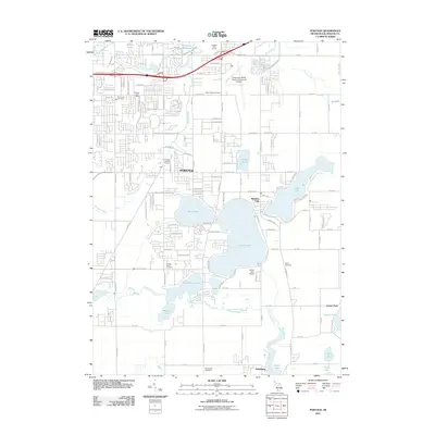
2011 Map of Portage
USGS Topo · Published 2011About this map
Portage and its southern neighbor Vicksburg anchor this suburban and lakeside landscape in Kalamazoo County. The terrain is defined by a dense network of water bodies, including the expansive Austin Lake, West Lake, and the winding Gourdneck Creek. This era of the city's development is marked by a mix of established residential neighborhoods and large-scale infrastructure, notably the Kalamazoo-Battle Creek International Airport and the smaller Austin Lake Airport. For local historians and genealogists, the map is particularly useful for its documentation of several burial grounds, such as Dry Prairie Cemetery and Indian Fields Cemetery, which stand alongside modern amenities like the Milham Golf Course and Ramona Park. The presence of the Monarch Millpond on Portage Creek hints at the area's earlier water-powered industrial roots, now integrated into a landscape of parks and planned communities.
Find a feature on this map
76 named features on this map. Tap any name to fly to it.
Don’t see what you’re looking for? This feature index may not catch every label — zoom into the map to look around manually.
Map Details
Editions of this 2011 Portage Map
This is the sole edition of this map. No revisions or reprints were ever made.
Other maps of this area

1916 · Kalamazoo
USGS Topo · 1:62,500

1918 · Kalamazoo
USGS Topo · 1:62,500

1918 · Galesburg
USGS Topo · 1:62,500

1918 · Leonidas
USGS Topo · 1:62,500

1922 · Schoolcraft
USGS Topo · 1:62,500

1943 · Kalamazoo
USGS Topo · 1:62,500

1943 · Schoolcraft
USGS Topo · 1:62,500

1944 · Leonidas
USGS Topo · 1:62,500

1944 · Galesburg
USGS Topo · 1:62,500

1947 · Galesburg
USGS Topo · 1:24,000