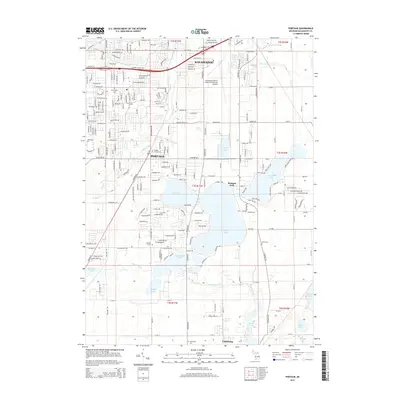
2014 Map of Portage
USGS Topo · Published 2014About this map
The suburban and industrial growth of Kalamazoo and Portage defines this landscape south of the city center. While residential development and the Kalamazoo/Battle Creek International Airport occupy the northern half, the southern portion is dominated by a complex of water bodies including Austin Lake, West Lake, and Long Lake. These lakes, alongside Ramona Park, illustrate the region's recreational character within a modernizing grid. Local history is anchored by several burial grounds, including Portage Central Cem, Portage S Cem, and Smith Cem, which remain as markers of earlier settlement patterns. The southern edge reaches toward Vicksburg, where the terrain shifts toward more open land around Gourdneck Lake and Gourdneck Creek.
Find a feature on this map
71 named features on this map. Tap any name to fly to it.
Don’t see what you’re looking for? This feature index may not catch every label — zoom into the map to look around manually.
Map Details
Editions of this 2014 Portage Map
This is the sole edition of this map. No revisions or reprints were ever made.
Other maps of this area

1916 · Kalamazoo
USGS Topo · 1:62,500

1918 · Kalamazoo
USGS Topo · 1:62,500

1918 · Galesburg
USGS Topo · 1:62,500

1918 · Leonidas
USGS Topo · 1:62,500

1922 · Schoolcraft
USGS Topo · 1:62,500

1943 · Kalamazoo
USGS Topo · 1:62,500

1943 · Schoolcraft
USGS Topo · 1:62,500

1944 · Leonidas
USGS Topo · 1:62,500

1944 · Galesburg
USGS Topo · 1:62,500

1947 · Galesburg
USGS Topo · 1:24,000