Loading...
Loading map...2023 Map of Portage
USGS Topo · Published 2023About this map
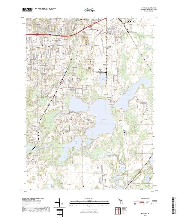
Kalamazoo and Portage anchor this modern-day view of a landscape defined by its glacial kettle lakes and evolving urban fringe. The southern reaches of the city of Kalamazoo transition into the residential and industrial corridors of Portage, where Upjohn Pond and the Kalamazoo/Battle Creek International Airport represent the region's significant economic and manufacturing footprint.
Find a feature on this map
43 named features on this map. Tap any name to fly to it.
Don’t see what you’re looking for? This feature index may not catch every label — zoom into the map to look around manually.
Map Details
Date Portrayed2023
Date Published2023
PublisherU.S. Geological Survey
Map TypeTopographic
Scale1:24000
Physical Dimensions24 x 29 inches
Editions of this 2023 Portage Map
This is the sole edition of this map. No revisions or reprints were ever made.
Historical Maps of Kalamazoo Through Time
Featured Locations
- Schoolcraft Township, MI
- Kalamazoo, MI
- Pavilion Township, MI
- Portage, MI
- Vicksburg, Schoolcraft Township
Source Details
SourceU.S. Geological Survey
CopyrightPublic Domain