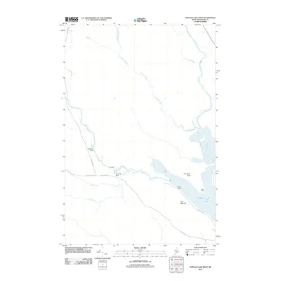
2011 Map of Portage Lake West
USGS Topo · Published 2011About this map
Fish River dominates this northern Maine landscape, winding through a network of bends and points before feeding into the western reaches of Portage Lake. This 2011 survey documents a heavily wooded terrain shaped by its waterways, including Mosquito Brook and Dead Brook in the north and Chase Brook to the south. Notable shoreline features such as Indian Point and Oak Point characterize the lake's edge, while West Mountain and Hutchinson Ridge provide significant topographic relief. The transportation network is defined by rural access routes including Hewes Brook Rd, W Side Echo Lake Rd, and Fish Lake Rd, which connect remote camps and timber lands. Local landmarks like Hay Shed Bend and Big Pine Bend reflect a history of river-based activity and logging traditions in the Aroostook County wilderness.
Find a feature on this map
19 named features on this map. Tap any name to fly to it.
Don’t see what you’re looking for? This feature index may not catch every label — zoom into the map to look around manually.
Map Details
Editions of this 2011 Portage Lake West Map
This is the sole edition of this map. No revisions or reprints were ever made.
Other maps of this area

1928 · Winterville
USGS Topo · 1:48,000

1929 · Portage
USGS Topo · 1:62,500

1930 · Greenlaw
USGS Topo · 1:48,000

1931 · Ashland
USGS Topo · 1:48,000

1931 · Portage
USGS Topo · 1:62,500

1931 · Winterville
USGS Topo · 1:62,500

1933 · Greenlaw
USGS Topo · 1:62,500

1934 · Ashland
USGS Topo · 1:62,500

1953 · Ashland
USGS Topo · 1:62,500

1953 · Portage
USGS Topo · 1:62,500