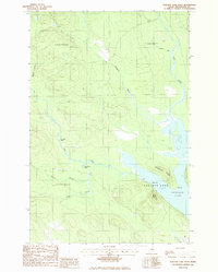
1986 Map of Portage Lake West
USGS Topo · Published 1986About this map
Portage Lake dominates the southeastern quadrant of this mid-1980s survey, representing a critical water body in the northern Maine wilderness. The map details the complex hydrology of the region, where the Fish River winds southward, characterized by distinctive meanders such as Big Pine Bend and Hay Shed Bend. The terrain is defined by significant elevations and ridges that overlook the water, notably West Mtn and Hutchinson Ridge, providing a clear picture of the natural geography before further modern development.
Find a feature on this map
18 named features on this map. Tap any name to fly to it.
Don’t see what you’re looking for? This feature index may not catch every label — zoom into the map to look around manually.
Map Details
Editions of this 1986 Portage Lake West Map
This is the sole edition of this map. No revisions or reprints were ever made.
Other maps of this area

1928 · Winterville
USGS Topo · 1:48,000

1929 · Portage
USGS Topo · 1:62,500

1930 · Greenlaw
USGS Topo · 1:48,000

1931 · Ashland
USGS Topo · 1:48,000

1931 · Portage
USGS Topo · 1:62,500

1931 · Winterville
USGS Topo · 1:62,500

1933 · Greenlaw
USGS Topo · 1:62,500

1934 · Ashland
USGS Topo · 1:62,500

1953 · Ashland
USGS Topo · 1:62,500

1953 · Portage
USGS Topo · 1:62,500