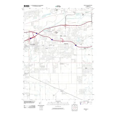
2010 Map of Portage
USGS Topo · Published 2010About this map
Lake Station and Portage anchor this detailed study of the industrial and residential corridors east of Gary, where the drainage of the Little Calumet River and its East Arm shaped the early development of the region. The landscape is a complex intersection of historic settlements like Crisman, Garyton, and McCool alongside modern infrastructure. Genealogy researchers will find significant value in the high density of burial sites across the quadrangle, ranging from the Temple of Israel Cemetery of Gary and Saint Francis Xavier Cemetery to family-named plots such as Blake Cemetery and Robbins Cemetery. The southern portion of the map transitions toward more open spaces around Wheeler, defined by the winding paths of Duck Creek and Pepper Creek, illustrating the shift from the heavy transportation corridors of the north to the more traditional agricultural grid of Lake and Porter Counties.
Find a feature on this map
52 named features on this map. Tap any name to fly to it.
Don’t see what you’re looking for? This feature index may not catch every label — zoom into the map to look around manually.
Map Details
Editions of this 2010 Portage Map
This is the sole edition of this map. No revisions or reprints were ever made.
Other maps of this area

1900 · Toleston
USGS Topo · 1:62,500

1934 · Porter
USGS Topo · 1:48,000

1940 · Porter
USGS Topo · 1:62,500

1953 · Palmer
USGS Topo · 1:24,000

1953 · Gary
USGS Topo · 1:24,000

1953 · Crown Point
USGS Topo · 1:24,000

1953 · Garyton
USGS Topo · 1:24,000

1953 · Valparaiso
USGS Topo · 1:24,000

1953 · Ogden Dunes
USGS Topo · 1:24,000

1953 · Chesterton
USGS Topo · 1:24,000