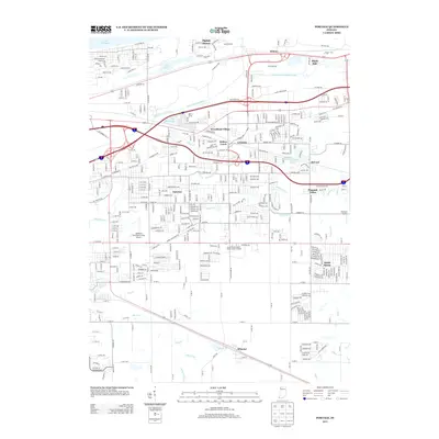
2013 Map of Portage
USGS Topo · Published 2013About this map
Ogden Dunes sits on the edge of Lake Michigan in this survey of Porter and Lake Counties. The landscape is defined by its complex drainage network, where the Little Calumet River and E Arm Little Calumet River provide the primary east-west hydrology, supplemented by engineered waterways like Robbins Ditch and peregrine Ditch. These systems historically managed the wetlands to allow for the growth of communities such as Garyton, Willow Creek, and McCool. Farther south, the transition into agricultural and residential developments is marked by the presence of Wheeler and South Haven. The transportation corridor is heavily reinforced by numerous local roads and small airfields like the Johnsons Strawberry Farm Airport and Flying M Airport, showing the intersection of heavy infrastructure and the lingering rural character of northern Indiana.
Find a feature on this map
193 named features on this map. Tap any name to fly to it.
Don’t see what you’re looking for? This feature index may not catch every label — zoom into the map to look around manually.
Map Details
Editions of this 2013 Portage Map
This is the sole edition of this map. No revisions or reprints were ever made.
Other maps of this area

1900 · Toleston
USGS Topo · 1:62,500

1934 · Porter
USGS Topo · 1:48,000

1940 · Porter
USGS Topo · 1:62,500

1953 · Palmer
USGS Topo · 1:24,000

1953 · Gary
USGS Topo · 1:24,000

1953 · Crown Point
USGS Topo · 1:24,000

1953 · Garyton
USGS Topo · 1:24,000

1953 · Valparaiso
USGS Topo · 1:24,000

1953 · Ogden Dunes
USGS Topo · 1:24,000

1953 · Chesterton
USGS Topo · 1:24,000