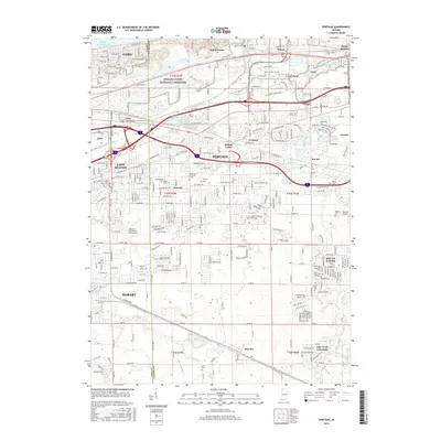
2016 Map of Portage
USGS Topo · Published 2016About this map
Indiana Dunes National Lakeshore dominates the northern coastline of this Porter County landscape, where the shifting sands of Lake Michigan meet an intricate network of waterways including the Little Calumet River and Long Lake. The area reflects a complex transition from protected natural spaces to the industrial and suburban growth of Portage and Gary. This 2016 survey captures the density of established neighborhoods like Garyton, South Haven, and Lake Station, alongside the persistent legacy of smaller settlements such as Crisman, McCool, and Wheeler. Genealogists will find several local burial sites documented, including Calvary Cem, Blake Cem, and McCool Cem. The map also highlights unique local landmarks such as Johnsons Strawberry Farm Airport and the Temple of Israel Cem, illustrating how agricultural roots and diverse community spaces coexist with modern infrastructure and drainage systems like Crisman Ditch and Roper Ditch.
Find a feature on this map
148 named features on this map. Tap any name to fly to it.
Don’t see what you’re looking for? This feature index may not catch every label — zoom into the map to look around manually.
Map Details
Editions of this 2016 Portage Map
This is the sole edition of this map. No revisions or reprints were ever made.
Other maps of this area

1900 · Toleston
USGS Topo · 1:62,500

1934 · Porter
USGS Topo · 1:48,000

1940 · Porter
USGS Topo · 1:62,500

1953 · Palmer
USGS Topo · 1:24,000

1953 · Gary
USGS Topo · 1:24,000

1953 · Crown Point
USGS Topo · 1:24,000

1953 · Garyton
USGS Topo · 1:24,000

1953 · Valparaiso
USGS Topo · 1:24,000

1953 · Ogden Dunes
USGS Topo · 1:24,000

1953 · Chesterton
USGS Topo · 1:24,000