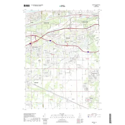
2019 Map of Portage
USGS Topo · Published 2019About this map
Indiana Dunes National Park and the industrial corridors of Northwest Indiana define this landscape along the southern shores of Lake Michigan. The transition from the protected dunes and marshes of Ogden Dunes and Burns Harbor to the residential grids of Portage and Gary reveals a complex mix of conservation and mid-century suburban expansion. The map identifies several smaller communities like Crisman, Willow Creek, and McCool, many of which have been absorbed into the larger municipal boundaries of Portage and Lake Station.
Find a feature on this map
164 named features on this map. Tap any name to fly to it.
Don’t see what you’re looking for? This feature index may not catch every label — zoom into the map to look around manually.
Map Details
Editions of this 2019 Portage Map
This is the sole edition of this map. No revisions or reprints were ever made.
Other maps of this area

1900 · Toleston
USGS Topo · 1:62,500

1934 · Porter
USGS Topo · 1:48,000

1940 · Porter
USGS Topo · 1:62,500

1953 · Palmer
USGS Topo · 1:24,000

1953 · Gary
USGS Topo · 1:24,000

1953 · Crown Point
USGS Topo · 1:24,000

1953 · Garyton
USGS Topo · 1:24,000

1953 · Valparaiso
USGS Topo · 1:24,000

1953 · Ogden Dunes
USGS Topo · 1:24,000

1953 · Chesterton
USGS Topo · 1:24,000