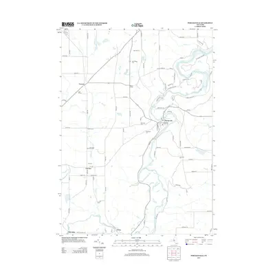
2013 Map of Portageville
USGS Topo · Published 2013About this map
The Genesee River carves a dramatic path through this region, defining the eastern landscape within Letchworth State Park. The river’s descent is marked by the Upper Falls and Middle Falls, features that historically anchored the nearby settlement of Portageville. This 2013 survey provides a detailed look at the rural intersections and agricultural tracts of Wyoming and Livingston Counties, including family operations like Apple Hill Farms and Ward Brothers Farm.
Find a feature on this map
85 named features on this map. Tap any name to fly to it.
Don’t see what you’re looking for? This feature index may not catch every label — zoom into the map to look around manually.
Map Details
Editions of this 2013 Portageville Map
This is the sole edition of this map. No revisions or reprints were ever made.
Other maps of this area

1905 · Portage
USGS Topo · 1:62,500

1905 · Nunda
USGS Topo · 1:62,500

1906 · Angelica
USGS Topo · 1:62,500

1916 · Canaseraga
USGS Topo · 1:62,500

1940 · Canaseraga
USGS Topo · 1:62,500

1941 · Angelica
USGS Topo · 1:62,500

1943 · Mount Morris
USGS Topo · 1:24,000

1943 · Warsaw
USGS Topo · 1:24,000

1943 · Nunda
USGS Topo · 1:24,000

1943 · Castile
USGS Topo · 1:24,000