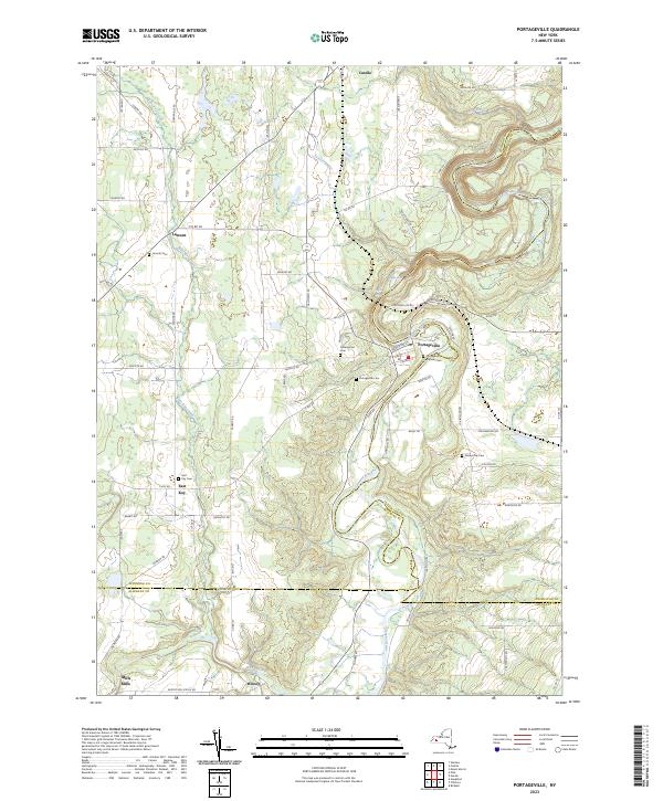
2023 Map of Portageville
USGS Topo · Published 2023About this map
The Genesee River carves a deep path through this landscape, marked by the dramatic descent of Upper Falls, Middle Falls, and Lower Falls. This modern record of the terrain at the tri-county junction of Wyoming, Livingston, and Allegany Counties highlights a settlement pattern defined by waterpower and high-plateau agriculture. Portageville sits at the heart of this riverine geography, while the outlying hamlets of Lamont, East Koy, and Wiscoy remain connected by a network of rural roads such as Griffith Rd and Pennycook Rd. For genealogists, the map is particularly useful for its documentation of local burial grounds, including the Portageville Pioneer Cem, Assumption Cem, and Pennycook Cem. The course of East Koy Creek and Wolf Creek further underscores the drainage patterns that have shaped the development of these small Western New York communities.
Find a feature on this map
73 named features on this map. Tap any name to fly to it.
Don’t see what you’re looking for? This feature index may not catch every label — zoom into the map to look around manually.
Map Details
Editions of this 2023 Portageville Map
This is the sole edition of this map. No revisions or reprints were ever made.
Other maps of this area

1905 · Portage
USGS Topo · 1:62,500

1905 · Nunda
USGS Topo · 1:62,500

1906 · Angelica
USGS Topo · 1:62,500

1916 · Canaseraga
USGS Topo · 1:62,500

1940 · Canaseraga
USGS Topo · 1:62,500

1941 · Angelica
USGS Topo · 1:62,500

1943 · Mount Morris
USGS Topo · 1:24,000

1943 · Warsaw
USGS Topo · 1:24,000

1943 · Nunda
USGS Topo · 1:24,000

1943 · Castile
USGS Topo · 1:24,000