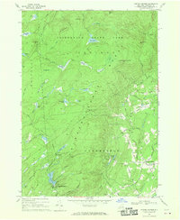
1968 Map of Porter Corners
USGS Topo · Published 1970About this map
Adirondack State Park dominates the northern half of this landscape, where the high ridges of Spruce Mtn and Hedgehog Mtn look down upon a network of distinctively named valley wetlands or "vlys." This era reveals a transition from traditional logging and rural life to early recreation, as evidenced by the Brookhaven Golf Club and the Sky Ranch development. In the southeast, the settlement of Porter Corners serves as the primary hub, surrounded by family-named infrastructure such as Ballou Road and Medbury Road. Genealogists will find value in the specific placement of the Ballou Cem and Hutchins Cem, while the interior of the park is crisscrossed by old trails and jeep roads leading to Lake Desolation and various mountain summits.
Find a feature on this map
64 named features on this map. Tap any name to fly to it.
Don’t see what you’re looking for? This feature index may not catch every label — zoom into the map to look around manually.
Map Details
Editions of this 1968 Porter Corners Map
2 editions found
Other maps of this area

1899 · Broadalbin
USGS Topo · 1:62,500

1902 · Broadalbin
USGS Topo · 1:62,500

1902 · Saratoga
USGS Topo · 1:62,500

1903 · Luzerne
USGS Topo · 1:62,500

1910 · Stony Creek
USGS Topo · 1:62,500

1934 · Saratoga Springs
USGS Topo · 1:24,000

1935 · Middle Grove
USGS Topo · 1:24,000

1935 · Corinth
USGS Topo · 1:24,000

1942 · Saratoga
USGS Topo · 1:62,500

1945 · Edinburg
USGS Topo · 1:24,000