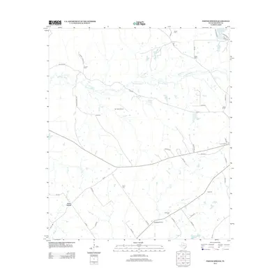
2013 Map of Porter Springs
USGS Topo · Published 2013About this map
Porter Springs sits at the western edge of this Houston County landscape, where the terrain transitions from the open stretches of Mustang Prairie to a complex network of waterways. The area is defined by the winding course of Hurricane Bayou and its tributaries, including Spring Cr and Henderson Cr. This rural Texan geography is notable for its high concentration of family and community burial grounds, which serve as primary anchors for local genealogy. Researchers can trace the placement of several such sites, including Wesley Cem in the north and Mt Moriah Cem further south. The settlement patterns are distinctly rural, with small communities like Gary Hill and Langum Quarter connected by a web of county roads and farm-to-market routes. Aviation history is represented by the MY Ranch Airport, while several small lakes, such as Butler Lake and Wirt Lake, dot the drainage basins between the bayous.
Find a feature on this map
55 named features on this map. Tap any name to fly to it.
Don’t see what you’re looking for? This feature index may not catch every label — zoom into the map to look around manually.
Map Details
Editions of this 2013 Porter Springs Map
This is the sole edition of this map. No revisions or reprints were ever made.
Other maps of this area

1950 · Crockett
USGS Topo · 1:24,000

1951 · Crockett
USGS Topo · 1:24,000

1951 · Grapeland
USGS Topo · 1:24,000

1953 · Palestine
USGS Topo · 1:250,000

1957 · Palestine
USGS Topo · 1:250,000

1963 · Lovelady North
USGS Topo · 1:24,000

1964 · Austonio
USGS Topo · 1:24,000

1964 · Porter Springs
USGS Topo · 1:24,000

1964 · Pearsons Chapel
USGS Topo · 1:24,000

1964 · Halls Bluff
USGS Topo · 1:24,000