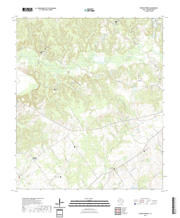
2022 Map of Porter Springs
USGS Topo · Published 2022About this map
Porter Springs serves as the focal point for this landscape in Houston County, characterized by a complex network of bayous and creeks that drain the East Texas terrain. The topographic detail reveals how water shapes the land, with the winding course of Hurricane Bayou and Big Cr defining the lowlands. This area is particularly significant for genealogical research, as it contains numerous family and community burial grounds, including the Wesley Chapel Cem - East and Wesley Chapel Cem - West in the north, and the Elisha Clapp Cem further south. The map documents the rural infrastructure of the early twenty-first century, showing the M Y Ranch Airport alongside established routes like FM 2076 and FM 132. Landmarks such as Gary Hill and various small lakes like Skalicky Lake and Wirt Lake provide additional points of reference across this agricultural and forested region.
Find a feature on this map
55 named features on this map. Tap any name to fly to it.
Don’t see what you’re looking for? This feature index may not catch every label — zoom into the map to look around manually.
Map Details
Editions of this 2022 Porter Springs Map
This is the sole edition of this map. No revisions or reprints were ever made.
Other maps of this area

1950 · Crockett
USGS Topo · 1:24,000

1951 · Crockett
USGS Topo · 1:24,000

1951 · Grapeland
USGS Topo · 1:24,000

1953 · Palestine
USGS Topo · 1:250,000

1957 · Palestine
USGS Topo · 1:250,000

1963 · Lovelady North
USGS Topo · 1:24,000

1964 · Austonio
USGS Topo · 1:24,000

1964 · Porter Springs
USGS Topo · 1:24,000

1964 · Pearsons Chapel
USGS Topo · 1:24,000

1964 · Halls Bluff
USGS Topo · 1:24,000