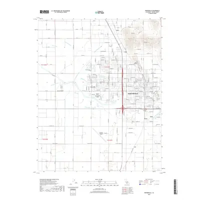
2018 Map of Porterville
USGS Topo · Published 2018About this map
Porterville serves as the central hub of this San Joaquin Valley landscape, where the urban grid meets a complex network of irrigation and hydrology. The Tule River and Porter Slough thread through the settlement, supported by a sophisticated system of man-made waterways including the Friant-Kern Canal, Poplar Ditch, and Hubbs Miner Ditch. These features illustrate the engineering required to sustain agriculture in the Central Valley. Surrounding the city center are distinct neighborhoods and smaller locales such as Scenic Heights, Nanceville, and the community of Plano. Significant local landmarks like Porterville College and the Porterville Municipal Airport are documented alongside historic burial grounds such as Saint Anns Cem and Vandalia Cem, providing a detailed record of the region's mid-century development and institutional growth.
Find a feature on this map
178 named features on this map. Tap any name to fly to it.
Don’t see what you’re looking for? This feature index may not catch every label — zoom into the map to look around manually.
Map Details
Editions of this 2018 Porterville Map
This is the sole edition of this map. No revisions or reprints were ever made.
Other maps of this area

1904 · Kaweah
USGS Topo · 1:125,000

1909 · Kaweah
USGS Topo · 1:125,000

1927 · Cairns Corner
USGS Topo · 1:31,680

1928 · Woodville
USGS Topo · 1:31,680

1928 · Lindsay
USGS Topo · 1:31,680

1929 · Sausalito School
USGS Topo · 1:31,680

1929 · Porterville
USGS Topo · 1:31,680

1929 · Ducor
USGS Topo · 1:31,680

1936 · White River
USGS Topo · 1:62,500

1936 · Tobias Peak
USGS Topo · 1:125,000