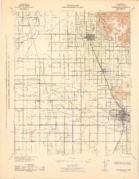
1942 Map of Porterville
USGS Topo · Published 1942About this map
Agricultural development in the San Joaquin Valley defines this mid-century landscape, where a sophisticated network of canals like Rice Ditch and Stockton Ditch sustain the region's orchards and fields. The city of Porterville serves as the primary hub, situated where the Tule River emerges from the foothills into the valley floor. To the north, the town of Lindsay sits at the base of Elephant Back and the Rocky Hills, marking the transition from the flat basin to the elevated terrain of Round Valley.
Find a feature on this map
137 named features on this map. Tap any name to fly to it.
Don’t see what you’re looking for? This feature index may not catch every label — zoom into the map to look around manually.
Map Details
Editions of this 1942 Porterville Map
2 editions found
Other maps of this area

1904 · Kaweah
USGS Topo · 1:125,000

1909 · Kaweah
USGS Topo · 1:125,000

1925 · Rocky Hill
USGS Topo · 1:31,680

1925 · Tulare
USGS Topo · 1:31,680

1925 · Tipton
USGS Topo · 1:31,680

1926 · Exeter
USGS Topo · 1:31,680

1927 · Cairns Corner
USGS Topo · 1:31,680

1927 · Rocky Hill
USGS Topo · 1:31,680

1927 · Visalia
USGS Topo · 1:31,680

1927 · Tulare
USGS Topo · 1:31,680