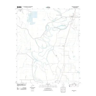
2011 Map of Portland
USGS Topo · Published 2011About this map
Bayou Bartholomew meanders heavily through the center of this Ashley County landscape, defining the local geography with its sharp oxbows and surrounding wetlands. The town of Portland is situated in the northeastern corner, serving as a primary settlement along the corridor between Dry Bayou and the main waterway. This 2011 survey captures a rural environment where land use is dictated by the water, including the engineered Wilson Brake Reservoir and its associated Wilson Brake Dam. To the south, the community of Sunshine sits along the road network, while Mount Pleasant and its adjacent Mount Pleasant Cemetery occupy the northwestern quadrant. Genealogists and local historians can locate several burial grounds preserved in the agricultural landscape, such as Saint Marion Cemetery and Portland Cemetery, which offer key points of reference for families rooted in this part of Arkansas.
Find a feature on this map
39 named features on this map. Tap any name to fly to it.
Don’t see what you’re looking for? This feature index may not catch every label — zoom into the map to look around manually.
Map Details
Editions of this 2011 Portland Map
This is the sole edition of this map. No revisions or reprints were ever made.
Other maps of this area

1935 · Mist
USGS Topo · 1:62,500

1935 · Wilmot
USGS Topo · 1:62,500

1936 · Eudora
USGS Topo · 1:62,500

1936 · Lake Village
USGS Topo · 1:62,500

1953 · Greenwood
USGS Topo · 1:250,000

1955 · Lake Village
USGS Topo · 1:62,500

1956 · Greenwood
USGS Topo · 1:250,000

1957 · Eudora
USGS Topo · 1:62,500

1960 · Snyder
USGS Topo · 1:24,000

1960 · Mist
USGS Topo · 1:62,500