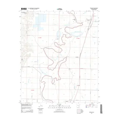
2014 Map of Portland
USGS Topo · Published 2014About this map
Bayou Bartholomew meanders through the heart of this Southeast Arkansas landscape, defining a complex drainage pattern alongside Dry Bayou and the Overflow Creek bottomlands. The town of Portland serves as the primary settlement, situated along the Us 165 HWY N corridor and the railroad tracks of N Railroad St. This 2014 survey documents a predominantly agricultural region where water management is central, evidenced by features like the Wilson Brake Reservoir and Sanders Lake. Genealogists and local historians can locate several rural burial grounds, including Holly Grove Cem near the bayou's edge and Saint Marion Cem further south. The map also records smaller communities like Sunshine and Mount Pleasant, alongside the Beech Creek Airport, providing a detailed look at the rural infrastructure of Ashley County in the early 21st century.
Find a feature on this map
55 named features on this map. Tap any name to fly to it.
Don’t see what you’re looking for? This feature index may not catch every label — zoom into the map to look around manually.
Map Details
Editions of this 2014 Portland Map
This is the sole edition of this map. No revisions or reprints were ever made.
Other maps of this area

1935 · Mist
USGS Topo · 1:62,500

1935 · Wilmot
USGS Topo · 1:62,500

1936 · Eudora
USGS Topo · 1:62,500

1936 · Lake Village
USGS Topo · 1:62,500

1953 · Greenwood
USGS Topo · 1:250,000

1955 · Lake Village
USGS Topo · 1:62,500

1956 · Greenwood
USGS Topo · 1:250,000

1957 · Eudora
USGS Topo · 1:62,500

1960 · Snyder
USGS Topo · 1:24,000

1960 · Mist
USGS Topo · 1:62,500