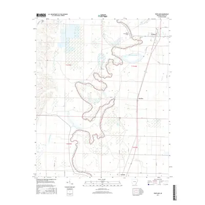
2017 Map of Portland
USGS Topo · Published 2017About this map
Bayou Bartholomew snakes through the heart of this Ashley County landscape, defining the local geography with its intricate oxbows and marshy lowlands. The settlement of Portland sits near the northern boundary, anchored by the Portland Cem and the Bayou Bartholomew Bridge. This alluvial terrain is dotted with seasonal water features like Bear Brake and Saint Marion Brake, indicating a landscape deeply tied to the ebb and flow of the Delta's drainage systems. To the south, the community of Parkdale and the smaller locality of Sunshine mark the transition toward more open agricultural lands. Genealogists will find several burial sites preserved on this sheet, including Holly Grove Cem and Mount Pleasant Cem, which serve as vital markers of the area's rural history and long-standing family foundations.
Find a feature on this map
39 named features on this map. Tap any name to fly to it.
Don’t see what you’re looking for? This feature index may not catch every label — zoom into the map to look around manually.
Map Details
Editions of this 2017 Portland Map
This is the sole edition of this map. No revisions or reprints were ever made.
Other maps of this area

1935 · Mist
USGS Topo · 1:62,500

1935 · Wilmot
USGS Topo · 1:62,500

1936 · Eudora
USGS Topo · 1:62,500

1936 · Lake Village
USGS Topo · 1:62,500

1953 · Greenwood
USGS Topo · 1:250,000

1955 · Lake Village
USGS Topo · 1:62,500

1956 · Greenwood
USGS Topo · 1:250,000

1957 · Eudora
USGS Topo · 1:62,500

1960 · Snyder
USGS Topo · 1:24,000

1960 · Mist
USGS Topo · 1:62,500