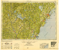
1949 Map of Portland
USGS Topo · Published 1951About this map
Casco Bay and the islands of southern Maine anchor the eastern edge of this regional survey, which spans from the Atlantic coast into the heart of the White Mountain National Forest. The landscape is defined by its deep glacial lakes, including Lake Winnipesaukee, Sebago Lake, and Massabesic Lake, which serve as natural hubs for the surrounding settlements. Along the coastline, a network of maritime defenses like Fort Williams, Fort Preble, and Fort Dearborn guard the approaches to Portland and Portsmouth, while prominent beacons such as the Cape Elizabeth Lighthouse and Whaleback Lighthouse mark the shore.
Find a feature on this map
346 named features on this map. Tap any name to fly to it.
Don’t see what you’re looking for? This feature index may not catch every label — zoom into the map to look around manually.
Map Details
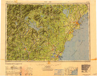
Editions of this 1949 Portland Map
3 editions found

Other maps of this area

1888 · Newburyport
USGS Topo · 1:62,500

1888 · Haverhill
USGS Topo · 1:62,500

1890 · Haverhill
USGS Topo · 1:62,500

1890 · Newburyport
USGS Topo · 1:62,500

1891 · Portland
USGS Topo · 1:62,500

1891 · Biddeford
USGS Topo · 1:62,500

1891 · Berwick
USGS Topo · 1:62,500

1891 · Kennebunk
USGS Topo · 1:62,500

1891 · Buxton
USGS Topo · 1:62,500

1891 · Newfield
USGS Topo · 1:62,500