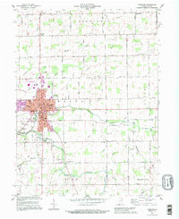
1992 Map of Portland
USGS Topo · Published 1995About this map
Portland serves as the regional hub in this 1990s revision, where the Salamonie River and Little Salamonie River converge. The town's grid is dense with civic infrastructure, including the Court House, City Hall, and the Haynes School. Beyond the urban center, the landscape transitions into a well-defined patchwork of sections and rural roads like Votaw Street and 100 South Road.
Find a feature on this map
67 named features on this map. Tap any name to fly to it.
Don’t see what you’re looking for? This feature index may not catch every label — zoom into the map to look around manually.
Map Details
Editions of this 1992 Portland Map
This is the sole edition of this map. No revisions or reprints were ever made.
Other maps of this area

1911 · Berne
USGS Topo · 1:48,000

1915 · Fort Recovery
USGS Topo · 1:48,000

1918 · Fort Recovery
USGS Topo · 1:62,500

1953 · Muncie
USGS Topo · 1:250,000

1956 · Muncie
USGS Topo · 1:250,000

1960 · Fort Recovery
USGS Topo · 1:24,000

1960 · Blaine
USGS Topo · 1:24,000
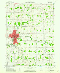
1960 · Portland
USGS Topo · 1:24,000
1960 · Cosmos
USGS Topo · 1:24,000

1960 · Ridgeville
USGS Topo · 1:24,000