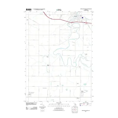
2011 Map of Portland South
USGS Topo · Published 2011About this map
The Grand River and its winding tributaries, including the Looking Glass River and Sebewa Creek, dominate this rural landscape in central Michigan. In the north, the city of Portland serves as a local hub, featuring the Portland Post Office and the large Portland City Cemetery. The southern half of the map transition into a grid of agricultural land and scattered smaller settlements like Sunfield and Mulliken, each anchored by its own postal facilities.
Find a feature on this map
72 named features on this map. Tap any name to fly to it.
Don’t see what you’re looking for? This feature index may not catch every label — zoom into the map to look around manually.
Map Details
Editions of this 2011 Portland South Map
This is the sole edition of this map. No revisions or reprints were ever made.
Other maps of this area

1916 · Ionia
USGS Topo · 1:62,500

1918 · Ionia
USGS Topo · 1:62,500

1943 · Ionia
USGS Topo · 1:62,500

1945 · Portland
USGS Topo · 1:62,500

1949 · Charlotte
USGS Topo · 1:62,500

1950 · Nashville
USGS Topo · 1:62,500

1951 · Nashville
USGS Topo · 1:62,500

1958 · Grand Rapids
USGS Topo · 1:250,000

1961 · Grand Rapids
USGS Topo · 1:250,000

1962 · Grand Rapids
USGS Topo · 1:250,000