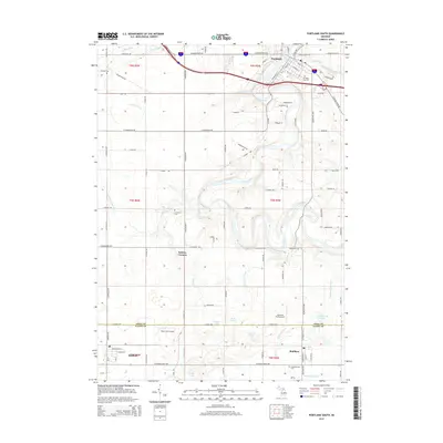
2014 Map of Portland South
USGS Topo · Published 2014About this map
The Grand River and Looking Glass River converge in the northern portion of this Michigan landscape, anchoring the settlement of Portland. This 2014 survey documents a region defined by agricultural plots and drainage networks such as the Stiffler Drain and Carbaugh Drain, which manage the water table for the surrounding farmsteads. Local history is well-preserved through a series of rural burying grounds, including Mathew Cem, E Sebewa Cem, and Danby Cem, each serving distinct townships. The map illustrates the transition from the concentrated street grid of Portland to the crossroads community at Sebewa Corners. Aviation interests are represented by the small Hiram Cure Airport and Airbatco Field Airport, which sit near the Ionia Co and Eaton Co border. This geography highlights a classic Midwestern land-use pattern where established watercourses continue to dictate the placement of towns and transport routes like E Grand River Ave.
Find a feature on this map
96 named features on this map. Tap any name to fly to it.
Don’t see what you’re looking for? This feature index may not catch every label — zoom into the map to look around manually.
Map Details
Editions of this 2014 Portland South Map
This is the sole edition of this map. No revisions or reprints were ever made.
Other maps of this area

1916 · Ionia
USGS Topo · 1:62,500

1918 · Ionia
USGS Topo · 1:62,500

1943 · Ionia
USGS Topo · 1:62,500

1945 · Portland
USGS Topo · 1:62,500

1949 · Charlotte
USGS Topo · 1:62,500

1950 · Nashville
USGS Topo · 1:62,500

1951 · Nashville
USGS Topo · 1:62,500

1958 · Grand Rapids
USGS Topo · 1:250,000

1961 · Grand Rapids
USGS Topo · 1:250,000

1962 · Grand Rapids
USGS Topo · 1:250,000