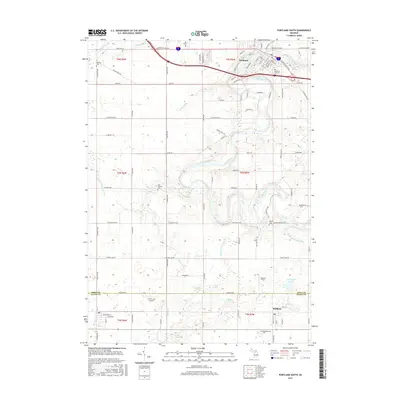
2017 Map of Portland South
USGS Topo · Published 2017About this map
The Grand River and Looking Glass River converge in the town of Portland, forming a central geography that has long influenced the development of this region. Moving south through rural Ionia and Eaton counties, the landscape transitions into a grid of agricultural land and managed waterways such as Sebewa Cr and the Gardner Hiar Drain. This survey documents several important local landmarks for genealogists, including the Portland City Cem, East Sebewa Cem, and Meadowbrook Cem near the town of Mulliken. Aviation history is present through small airfields like Airbatco Field and Hiram Cure Airport, which dot the open terrain between family farmsteads. The map also traces a complex network of county roads, including the historic Grand River Ave and Grand River Trl, reflecting the area's role as a transit corridor between larger Michigan hubs.
Find a feature on this map
99 named features on this map. Tap any name to fly to it.
Don’t see what you’re looking for? This feature index may not catch every label — zoom into the map to look around manually.
Map Details
Editions of this 2017 Portland South Map
This is the sole edition of this map. No revisions or reprints were ever made.
Other maps of this area

1916 · Ionia
USGS Topo · 1:62,500

1918 · Ionia
USGS Topo · 1:62,500

1943 · Ionia
USGS Topo · 1:62,500

1945 · Portland
USGS Topo · 1:62,500

1949 · Charlotte
USGS Topo · 1:62,500

1950 · Nashville
USGS Topo · 1:62,500

1951 · Nashville
USGS Topo · 1:62,500

1958 · Grand Rapids
USGS Topo · 1:250,000

1961 · Grand Rapids
USGS Topo · 1:250,000

1962 · Grand Rapids
USGS Topo · 1:250,000