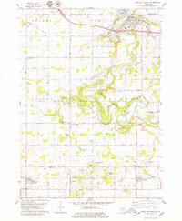
1978 Map of Portland South
USGS Topo · Published 1979About this map
The Grand River and Looking Glass River converge in the northern portion of this landscape, anchoring the development of Portland. The 1970s terrain is marked by the winding river valley and the expansive Portland State Game Area, which occupies much of the central river bottomlands. This survey illustrates a rural Michigan economy transitioning from traditional agriculture toward specialized infrastructure, as evidenced by the numerous Gravel Pits and Sandpits scattered along the glacial deposits of the river corridor. Small rural centers such as Sebewa Corners and Kent Corners persist as local hubs, while the Chesapeake and Ohio railroad provides the primary industrial link through the southern townships. Genealogists will find significant value in the documentation of family-named landmarks and remote burial sites, including East Sebewa Cem, Danby Cem, and Meadowbrook Cem.
Find a feature on this map
57 named features on this map. Tap any name to fly to it.
Don’t see what you’re looking for? This feature index may not catch every label — zoom into the map to look around manually.
Map Details
Editions of this 1978 Portland South Map
This is the sole edition of this map. No revisions or reprints were ever made.
Other maps of this area

1916 · Ionia
USGS Topo · 1:62,500

1918 · Ionia
USGS Topo · 1:62,500

1943 · Ionia
USGS Topo · 1:62,500

1945 · Portland
USGS Topo · 1:62,500

1949 · Charlotte
USGS Topo · 1:62,500

1950 · Nashville
USGS Topo · 1:62,500

1951 · Nashville
USGS Topo · 1:62,500

1958 · Grand Rapids
USGS Topo · 1:250,000

1961 · Grand Rapids
USGS Topo · 1:250,000

1962 · Grand Rapids
USGS Topo · 1:250,000