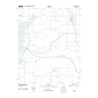
2010 Map of Porum
USGS Topo · Published 2010About this map
Porum sits at the northern edge of this Oklahoma landscape, where the prairie meets the high ground of Hi Early Mountain and Tater Hill. To the west, the massive reach of Eufaula Lake dominates the horizon, its waters managed by the Eufaula Dam near the bend of the Canadian River. This 2010 survey highlights a transition between upland ridges and the wide river valley, with the small community of Hoyt situated to the south. Local heritage is preserved in several family and community burial grounds, including the Starr Cemetery and Coleman Cemetery, which are scattered among the drainages of Belle Starr Creek. The presence of the Oknoname 101017 Dam and Porum Lake Dam indicates a modern water management system integrated into a region defined by its traditional bluffs and ridges, such as Taylor Bluff and Sandy Ridge.
Find a feature on this map
44 named features on this map. Tap any name to fly to it.
Don’t see what you’re looking for? This feature index may not catch every label — zoom into the map to look around manually.
Map Details
Editions of this 2010 Porum Map
This is the sole edition of this map. No revisions or reprints were ever made.
Other maps of this area

1900 · Sansbois
USGS Topo · 1:125,000

1909 · Sans Bois
USGS Topo · 1:125,000

1911 · Sansbois
USGS Topo · 1:125,000

1946 · Fort Smith
USGS Topo · 1:250,000

1962 · Stigler West
USGS Topo · 1:24,000

1963 · Porum
USGS Topo · 1:24,000

1963 · Warner NW
USGS Topo · 1:24,000
1963 · Holt Mountain
USGS Topo · 1:24,000

1963 · Texanna
USGS Topo · 1:24,000
1963 · Warner
USGS Topo · 1:24,000