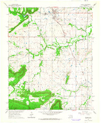
1963 Map of Warner
USGS Topo · Published 1964About this map
Connors State Agricultural College and the town of Warner serve as the focal point of this 1960s survey along the McIntosh and Muskogee county line. The landscape is defined by the transition from the high elevations of Nebo Mountain and Dunigan Mountain in the west to the alluvial basins of Martin Valley and Gap Prairie in the south. The Midland Valley railroad tracks provide the primary transportation spine, cutting diagonally across the terrain past a local Quarry and the Hatchery. Genealogy and local history are well-represented by rural landmarks like the Conley Sch and Popejoy Chapel, alongside several family burial grounds including Bennett Cem, Howland Cem, and Woodall Cem. These features, alongside the Sewage Disposal Pond and Warner Lake, illustrate the mid-century infrastructure and agricultural character of this Oklahoma community.
Find a feature on this map
24 named features on this map. Tap any name to fly to it.
Don’t see what you’re looking for? This feature index may not catch every label — zoom into the map to look around manually.
Map Details
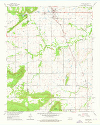
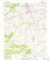
Editions of this 1963 Warner Map
3 editions found
Other maps of this area

1900 · Sansbois
USGS Topo · 1:125,000

1901 · Muscogee
USGS Topo · 1:125,000

1905 · Muscogee
USGS Topo · 1:125,000

1909 · Sans Bois
USGS Topo · 1:125,000

1911 · Sansbois
USGS Topo · 1:125,000

1946 · Fort Smith
USGS Topo · 1:250,000

1948 · Keefeton
USGS Topo · 1:62,500

1948 · Webbers Falls
USGS Topo · 1:62,500

1950 · Keefeton
USGS Topo · 1:62,500

1950 · Webbers Falls
USGS Topo · 1:62,500