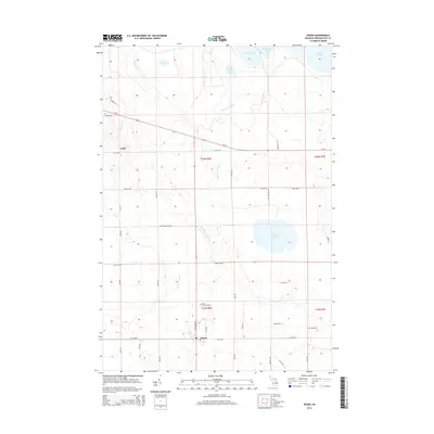
2014 Map of Posen
USGS Topo · Published 2014About this map
Posen serves as the primary hub of this inland Presque Isle County landscape, where agriculture and woodland are segmented by a grid of rural highways and local roads. The village is anchored by Michigan Ave and E 634 Hwy, with the nearby Saint Casimir's Cem reflecting the community's local heritage. To the north, the smaller settlement of Liske sits along Us-23, which cuts diagonally across the township toward the shoreline of Lake Huron visible in the northeast corner.
Find a feature on this map
42 named features on this map. Tap any name to fly to it.
Don’t see what you’re looking for? This feature index may not catch every label — zoom into the map to look around manually.
Map Details
Editions of this 2014 Posen Map
This is the sole edition of this map. No revisions or reprints were ever made.
Other maps of this area

1954 · Alpena
USGS Topo · 1:250,000

1955 · Hillman
USGS Topo · 1:62,500

1957 · Alpena
USGS Topo · 1:250,000

1958 · Alpena
USGS Topo · 1:250,000

1969 · Alpena
USGS Topo · 1:250,000

1971 · Long Lake West
USGS Topo · 1:24,000

1971 · Rogers City
USGS Topo · 1:24,000

1971 · Metz
USGS Topo · 1:24,000
1971 · Adams Point
USGS Topo · 1:24,000

1971 · Polaski
USGS Topo · 1:24,000