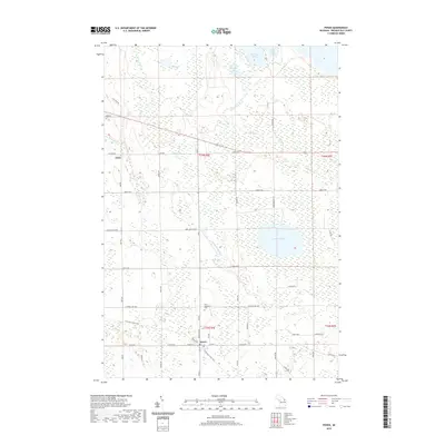
2019 Map of Posen
USGS Topo · Published 2019About this map
Posen stands as the primary hub in this portion of Presque Isle County, where the north-south corridor of Michigan Ave meets the historical route of the N Eastern State Trail. The town's local heritage is anchored by Saint Casimir's Cem, while the surrounding landscape is defined by an intricate network of wetlands and inland waters. To the north, the Swan River and the Little Trout River wind through the terrain, connecting a series of smaller basins such as Mud Lake, Penny Lake, and Big Trout Lake. The settlement of Liske appears to the northwest, situated among a dense grid of rural roads like Darga Hwy and E Co Rd 638. Dominating the eastern portion of the map is Lake Augusta, a significant water body that serves as a focal point for the local drainage and topography in this part of northern Michigan.
Find a feature on this map
44 named features on this map. Tap any name to fly to it.
Don’t see what you’re looking for? This feature index may not catch every label — zoom into the map to look around manually.
Map Details
Editions of this 2019 Posen Map
This is the sole edition of this map. No revisions or reprints were ever made.
Other maps of this area

1954 · Alpena
USGS Topo · 1:250,000

1955 · Hillman
USGS Topo · 1:62,500

1957 · Alpena
USGS Topo · 1:250,000

1958 · Alpena
USGS Topo · 1:250,000

1969 · Alpena
USGS Topo · 1:250,000

1971 · Long Lake West
USGS Topo · 1:24,000

1971 · Rogers City
USGS Topo · 1:24,000

1971 · Metz
USGS Topo · 1:24,000
1971 · Adams Point
USGS Topo · 1:24,000

1971 · Polaski
USGS Topo · 1:24,000