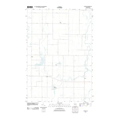
2010 Map of Poskin
USGS Topo · Published 2010About this map
Poskin and the surrounding Barron County landscape are defined by a rhythmic network of section-line roads and the winding paths of several watercourses. The Vermillion River meanders across the center of the sheet, joined by Quaderer Creek and the Yellow River to the east. This 2010 survey documents the rural character of the area, punctuated by numerous small cemeteries that anchor the local genealogy of the region, including Saint Lukes Cemetery to the north and the Lutheran Cemetery near the riverbanks. To the west, Poskin Lake and Crystal Bay Lake provide distinct landmarks in a terrain shaped by agriculture and water management, evidenced by the Sweeny Pond Creek 2WP1824 Dam and its associated reservoir, Sweeny Pond 6. The grid of avenues and streets, from 20th Ave down to 12th Ave, illustrates the persistence of the Public Land Survey System as the primary framework for settlement and transport in this part of Wisconsin.
Find a feature on this map
47 named features on this map. Tap any name to fly to it.
Don’t see what you’re looking for? This feature index may not catch every label — zoom into the map to look around manually.
Map Details
Editions of this 2010 Poskin Map
This is the sole edition of this map. No revisions or reprints were ever made.
Other maps of this area

1950 · Turtle Lake
USGS Topo · 1:62,500

1951 · Cumberland
USGS Topo · 1:48,000

1951 · Shell Lake
USGS Topo · 1:48,000

1951 · Barron
USGS Topo · 1:62,500

1952 · Turtle Lake
USGS Topo · 1:62,500

1953 · Rice Lake
USGS Topo · 1:250,000

1953 · Stillwater
USGS Topo · 1:250,000

1955 · Stillwater
USGS Topo · 1:250,000

1956 · Cumberland
USGS Topo · 1:62,500

1958 · Stillwater
USGS Topo · 1:250,000