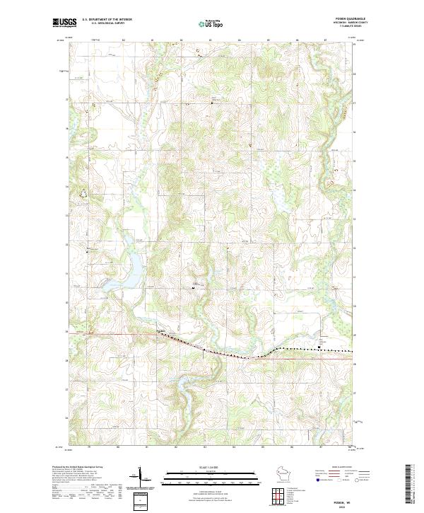
2022 Map of Poskin
USGS Topo · Published 2022About this map
The settlement of Poskin serves as the central hub for this portion of Barron County, where the Vermillion River meanders through a landscape defined by glacial topography and agricultural section lines. This 2022 survey captures a rural Wisconsin community anchored by its spiritual and historical landmarks, including the Poskin Lutheran Cem and Saint Lukes Cem to the north. The drainage patterns are a primary feature of the terrain, with Poskin Lake and the smaller Crystal Bay Lake providing local points of interest alongside the winding course of the Hay River and the Yellow River.
Find a feature on this map
37 named features on this map. Tap any name to fly to it.
Don’t see what you’re looking for? This feature index may not catch every label — zoom into the map to look around manually.
Map Details
Editions of this 2022 Poskin Map
This is the sole edition of this map. No revisions or reprints were ever made.
Other maps of this area

1950 · Turtle Lake
USGS Topo · 1:62,500

1951 · Cumberland
USGS Topo · 1:48,000

1951 · Shell Lake
USGS Topo · 1:48,000

1951 · Barron
USGS Topo · 1:62,500

1952 · Turtle Lake
USGS Topo · 1:62,500

1953 · Rice Lake
USGS Topo · 1:250,000

1953 · Stillwater
USGS Topo · 1:250,000

1955 · Stillwater
USGS Topo · 1:250,000

1956 · Cumberland
USGS Topo · 1:62,500

1958 · Stillwater
USGS Topo · 1:250,000