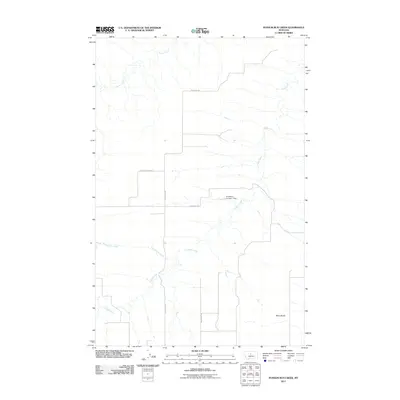
2011 Map of Possum Run Creek
USGS Topo · Published 2011About this map
Coffee Creek and its many winding tributaries define this central Montana landscape in Fergus County. The hydrology of the region is punctuated by the Kingsbury Number 1 Dam, which manages water flow near Kingsbury Rd. The terrain is characterized by broad elevated plains like Alton Bench in the southeast, situated among a network of rural routes including N Denton Rd and Broadback Rd. Further north and west, the drainages of Possum Run Creek and Arrow Creek carve through the prairie, illustrating the drainage patterns essential to the local ranching and agricultural economy. This topographic record reflects the sparse, functional layout of the high plains where infrastructure is built primarily around water management and connecting isolated properties.
Find a feature on this map
9 named features on this map. Tap any name to fly to it.
Don’t see what you’re looking for? This feature index may not catch every label — zoom into the map to look around manually.
Map Details
Editions of this 2011 Possum Run Creek Map
This is the sole edition of this map. No revisions or reprints were ever made.
Other maps of this area

1890 · Fort Benton
USGS Topo · 1:250,000

1892 · Fort Benton
USGS Topo · 1:250,000

1897 · Fort Benton
USGS Topo · 1:250,000

1954 · Great Falls
USGS Topo · 1:250,000

1954 · Lewistown
USGS Topo · 1:250,000

1957 · Great Falls
USGS Topo · 1:250,000

1959 · Lewistown
USGS Topo · 1:250,000

1964 · Spring Coulee
USGS Topo · 1:24,000

1972 · Square Butte SE
USGS Topo · 1:24,000
1978 · Strouf Island
USGS Topo · 1:24,000