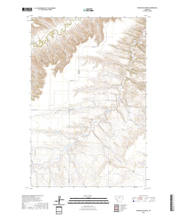
2024 Map of Possum Run Creek
USGS Topo · Published 2024About this map
Arrow Creek meanders through the northern reaches of this landscape, defining a significant portion of the boundary between Chouteau and Fergus counties. The geography is characterized by distinct elevated terraces including Arrow Creek Bench and Alton Bench, which overlook a network of drainage systems. Coffee Creek and the eponymous Possum Run Creek cut through the terrain, creating the deep coulees and draws typical of central Montana. A sparse grid of rural roads, such as N Denton Rd and Carpenter Rd, provide the primary access to these remote ranching lands. The lack of concentrated settlements highlights the area's agricultural character, where land use is dictated by the rugged topographic transitions between the flat benches and the eroded creek beds.
Find a feature on this map
14 named features on this map. Tap any name to fly to it.
Don’t see what you’re looking for? This feature index may not catch every label — zoom into the map to look around manually.
Map Details
Editions of this 2024 Possum Run Creek Map
This is the sole edition of this map. No revisions or reprints were ever made.
Other maps of this area

1890 · Fort Benton
USGS Topo · 1:250,000

1892 · Fort Benton
USGS Topo · 1:250,000

1897 · Fort Benton
USGS Topo · 1:250,000

1954 · Great Falls
USGS Topo · 1:250,000

1954 · Lewistown
USGS Topo · 1:250,000

1957 · Great Falls
USGS Topo · 1:250,000

1959 · Lewistown
USGS Topo · 1:250,000

1964 · Spring Coulee
USGS Topo · 1:24,000

1972 · Square Butte SE
USGS Topo · 1:24,000
1978 · Strouf Island
USGS Topo · 1:24,000