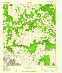
1958 Map of Post Oak Mountain
USGS Topo · Published 1961About this map
Cowhouse Creek meanders through the heart of the Fort Hood Military Reservation in this late-1950s study of the Texas Hill Country transition. The landscape is defined by a series of prominent limestone ridges and summits, including Post Oak Mountain, Smith Mountain, and Sugar Loaf Mountain, which tower over the surrounding drainage basins of Owl Creek and Nolan Creek. The southern edge of the map shows the rapid mid-century expansion of Killeen, where residential street grids for neighborhoods like Walker Village meet the military installation boundary.
Find a feature on this map
43 named features on this map. Tap any name to fly to it.
Don’t see what you’re looking for? This feature index may not catch every label — zoom into the map to look around manually.
Map Details
Editions of this 1958 Post Oak Mountain Map
2 editions found

Other maps of this area

1894 · Gatesville
USGS Topo · 1:125,000

1924 · Gatesville 4-d
USGS Topo · 1:48,000

1924 · Gatesville 4-a
USGS Topo · 1:48,000

1930 · Killeen
USGS Topo · 1:62,500

1947 · Fort Hood
USGS Topo · 1:62,500

1947 · Bland
USGS Topo · 1:24,000

1947 · Fort Hood
USGS Topo · 1:24,000

1947 · Purmela
USGS Topo · 1:62,500

1947 · Post Oak Mountain
USGS Topo · 1:24,000

1947 · Killeen
USGS Topo · 1:62,500