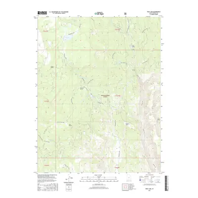
2017 Map of Posy Lake
USGS Topo · Published 2017About this map
Dixie National Forest defines this high-elevation landscape, where a dense network of paths and named hollows reveals a history of backcountry travel and water management. Named for a local figure, John Allen Bottom sits at the heart of a territory marked by numerous water sources, including Posy Lake, Cyclone Lake, and the marshy Tule Lakes. The map documents a rugged infrastructure of named routes such as the Great Western Trail and the Hells Backbone Rd, which navigate the deep incisions of Death Hollow and Coyote Hollow. These labels point to the area's legacy of ranching and early forest service administration, evidenced by features like Hog Ranch Spring and several designated snowmobile corridors that crisscross the high plateaus.
Find a feature on this map
41 named features on this map. Tap any name to fly to it.
Don’t see what you’re looking for? This feature index may not catch every label — zoom into the map to look around manually.
Map Details
Editions of this 2017 Posy Lake Map
This is the sole edition of this map. No revisions or reprints were ever made.
Other maps of this area

1885 · Fish Lake
USGS Topo · 1:250,000

1886 · Escalante
USGS Topo · 1:250,000

1896 · Fish Lake
USGS Topo · 1:250,000

1956 · Escalante
USGS Topo · 1:250,000

1956 · Salina
USGS Topo · 1:250,000

1960 · Escalante
USGS Topo · 1:250,000

1960 · Salina
USGS Topo · 1:250,000

1962 · Salina
USGS Topo · 1:250,000

1964 · Griffin Point
USGS Topo · 1:24,000

1964 · Barker Reservoir
USGS Topo · 1:24,000