
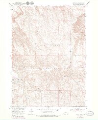
1950 Map of Potato Creek
USGS Topo · Published 1952About this map
Pine Ridge Indian Reservation lands dominate this mid-century landscape, characterized by the intricate drainage networks of Potato Creek and Lost Dog Creek. The small settlement of Potato Creek serves as the primary hub, surrounded by family-named landmarks and rural infrastructure essential to the era. The survey captures a moment of local transition, noting the Potato Creek Sch (Abandoned) while the Rock Springs Sch appears in the northern reaches. These school sites, along with the Bull Cem west of the main creek, provide a clear view of the communal centers that anchored this community within the Missouri River Basin development area. Topographical details reveal numerous Windmill sites across the terrain, reflecting the agricultural and ranching patterns that defined life on the reservation in the early 1950s.
Find a feature on this map
9 named features on this map. Tap any name to fly to it.
Don’t see what you’re looking for? This feature index may not catch every label — zoom into the map to look around manually.
Map Details
Editions of this 1950 Potato Creek Map
2 editions found
Other maps of this area

1950 · Interior
USGS Topo · 1:24,000

1950 · Interior SE
USGS Topo · 1:24,000

1951 · School Section Butte
USGS Topo · 1:24,000

1952 · Conata NE
USGS Topo · 1:24,000

1952 · Conata SE
USGS Topo · 1:24,000

1955 · Hot Springs
USGS Topo · 1:250,000

1955 · Martin
USGS Topo · 1:250,000

1958 · Martin
USGS Topo · 1:250,000

1980 · Kadoka
USGS Topo · 1:100,000

1981 · Wall
USGS Topo · 1:100,000