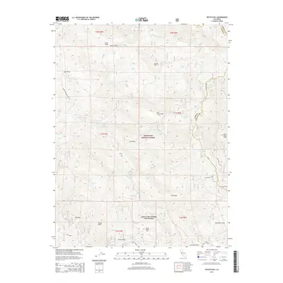
2015 Map of Potato Hill
USGS Topo · Published 2015About this map
Mendocino National Forest encompasses the majority of this terrain along the Lake County and Colusa County boundary. The landscape is defined by a dense network of ridges and water sources, including Potato Hill and the prominent Blue Slides Ridge. For those interested in historical water use and geothermal activity, the map identifies Crabtree Hot Springs situated along the Rice Fork. The presence of numerous named springs such as Madrone Spring, Kneebone Spring, and Rabbit Glade Spring indicates the critical importance of water access in this high-elevation backcountry. Settlement evidence is sparse, represented by specialized locations like Board Camp Ridge and the Upper Lake-Clearlake Oaks Division boundary. The topography is also dotted with glades, such as Mauser Glade and North Glade, which provide a distinct contrast to the surrounding forested ridges like French Ridge and Hale Ridge.
Find a feature on this map
52 named features on this map. Tap any name to fly to it.
Don’t see what you’re looking for? This feature index may not catch every label — zoom into the map to look around manually.
Map Details
Editions of this 2015 Potato Hill Map
This is the sole edition of this map. No revisions or reprints were ever made.
Other maps of this area

1922 · Hullville
USGS Topo · 1:62,500

1924 · Bartlett Springs
USGS Topo · 1:62,500

1938 · Lakeport
USGS Topo · 1:62,500

1942 · Bartlett Springs
USGS Topo · 1:62,500

1944 · Bartlett Springs
USGS Topo · 1:62,500

1951 · Lake Pillsbury
USGS Topo · 1:62,500

1951 · Lakeport
USGS Topo · 1:62,500

1951 · Stonyford
USGS Topo · 1:62,500

1957 · Ukiah
USGS Topo · 1:250,000
1958 · Bartlett Mtn
USGS Topo · 1:24,000