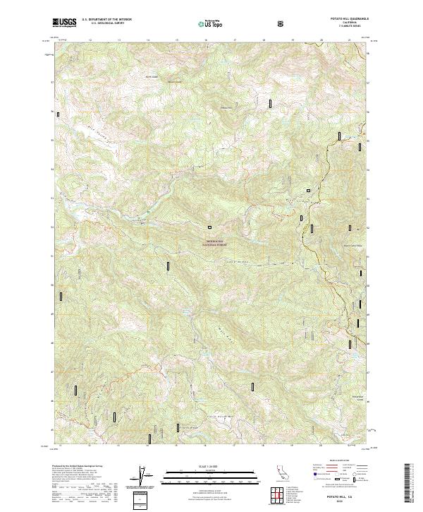
2022 Map of Potato Hill
USGS Topo · Published 2022About this map
Mendocino National Forest defines this high-elevation landscape, where a network of ridges and springs dictates the pattern of access and land use. Natural water sources are central to the geography of this area, ranging from the prominent Crabtree Hot Springs and Madrone Spring to high-altitude water bodies like Timber Lake and Blue Slides Lake. The terrain is characterized by massive features such as Potato Hill, Little Horse Mtn, and Long Ridge, while lower-lying areas like Rice Valley and Richardson Glade provide breaks in the topography. An extensive network of trails and fire roads, including the Blue Slides Trl and Big Ridge Trl, connects these remote points across the Lake and Colusa county line, illustrating the modern management and recreational navigation of this wilderness area.
Find a feature on this map
56 named features on this map. Tap any name to fly to it.
Don’t see what you’re looking for? This feature index may not catch every label — zoom into the map to look around manually.
Map Details
Editions of this 2022 Potato Hill Map
This is the sole edition of this map. No revisions or reprints were ever made.
Other maps of this area

1922 · Hullville
USGS Topo · 1:62,500

1924 · Bartlett Springs
USGS Topo · 1:62,500

1938 · Lakeport
USGS Topo · 1:62,500

1942 · Bartlett Springs
USGS Topo · 1:62,500

1944 · Bartlett Springs
USGS Topo · 1:62,500

1951 · Lake Pillsbury
USGS Topo · 1:62,500

1951 · Lakeport
USGS Topo · 1:62,500

1951 · Stonyford
USGS Topo · 1:62,500

1957 · Ukiah
USGS Topo · 1:250,000
1958 · Bartlett Mtn
USGS Topo · 1:24,000