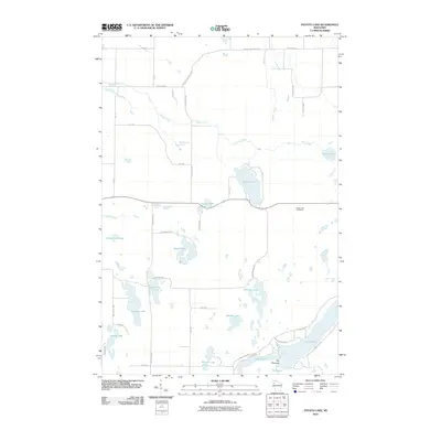
2010 Map of Potato Lake
USGS Topo · Published 2010About this map
Potato Lake and the surrounding glaciated basin in Washburn County define this landscape of dense water bodies and meandering streams. This 2010 survey documents a transition in rural geography where historic resource management, represented by the Potato Lake Fire Tower, stands near modern lakefront developments. The southern portion of the map is dominated by the sprawling reaches of Long Lake, including the distinctive passage known as The Narrows. Numerous smaller basins such as Glendennon Lake, Seymour Lake, and Leesome Lake are scattered across the terrain, connected by a network of drainage ways like Dugan Run and Potato Creek. The road system, including County Hwy M and County Hwy A, follows the contours of these waters, reflecting the traditional township-and-range grid adapted to the irregular northern Wisconsin topography.
Find a feature on this map
45 named features on this map. Tap any name to fly to it.
Don’t see what you’re looking for? This feature index may not catch every label — zoom into the map to look around manually.
Map Details
Editions of this 2010 Potato Lake Map
This is the sole edition of this map. No revisions or reprints were ever made.
Other maps of this area

1948 · Spooner
USGS Topo · 1:48,000

1948 · Stone Lake
USGS Topo · 1:48,000

1949 · Spooner
USGS Topo · 1:48,000

1949 · Rice Lake
USGS Topo · 1:48,000

1950 · Stone Lake
USGS Topo · 1:48,000

1951 · Shell Lake
USGS Topo · 1:48,000

1951 · Rice Lake
USGS Topo · 1:48,000

1953 · Rice Lake
USGS Topo · 1:250,000

1959 · Rice Lake
USGS Topo · 1:250,000

1965 · Rice Lake
USGS Topo · 1:62,500