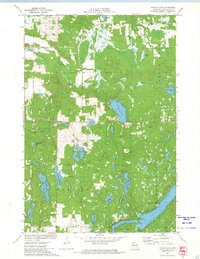
1971 Map of Potato Lake
USGS Topo · Published 1974About this map
Long Lake and the glacial terrain of Washburn County define this early 1970s landscape, characterized by an intricate network of waterways and wetlands. The map details a dense cluster of lakes including Potato Lake, Baker Lake, and Seymour Lake, many of which are connected by streams like Potato Creek. Large marshy expanses such as Crystal Swamp and localized water sources like Mackay Springs and Westenberg Spring highlight the region's hydrography before significant modern development. Cultural landmarks are sparse but specific, including a Lookout Tower in the eastern hills and a local Townhall near several Gravel Pits. The presence of multiple boat ramps and a picnic area indicates the area's established role for outdoor recreation. This survey captures the transition between the deep waters of The Narrows and the surrounding timberlands of Birchwood.
Find a feature on this map
29 named features on this map. Tap any name to fly to it.
Don’t see what you’re looking for? This feature index may not catch every label — zoom into the map to look around manually.
Map Details
Editions of this 1971 Potato Lake Map
This is the sole edition of this map. No revisions or reprints were ever made.
Other maps of this area

1948 · Spooner
USGS Topo · 1:48,000

1948 · Stone Lake
USGS Topo · 1:48,000

1949 · Spooner
USGS Topo · 1:48,000

1949 · Rice Lake
USGS Topo · 1:48,000

1950 · Stone Lake
USGS Topo · 1:48,000

1951 · Shell Lake
USGS Topo · 1:48,000

1951 · Rice Lake
USGS Topo · 1:48,000

1953 · Rice Lake
USGS Topo · 1:250,000

1959 · Rice Lake
USGS Topo · 1:250,000

1965 · Rice Lake
USGS Topo · 1:62,500