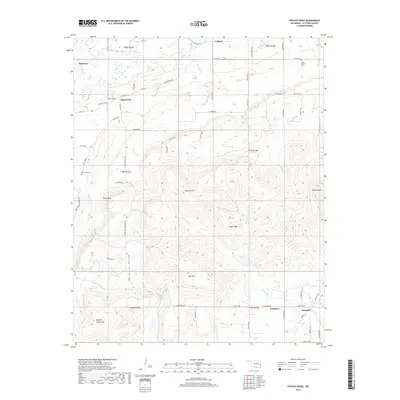
2018 Map of Potato Peaks
USGS Topo · Published 2018About this map
Potato Peaks and Sulphur Spring Mtn dominate the landscape of Le Flore County in this detailed survey of the terrain south of the Brazil Creek valley. Small residential clusters and historic crossroads like Latham, Dog Creek, and Bordeaux are spread across the northern plains, while the southern half of the map is defined by the steep, wooded rises of Wolf Mtn, Russell Mtn, and Deer Ridge. The mapping of local infrastructure highlights a network of county roads, including Latham Ridge Rd and Calhoun Rd, that navigate the gaps between these prominent heights.
Find a feature on this map
65 named features on this map. Tap any name to fly to it.
Don’t see what you’re looking for? This feature index may not catch every label — zoom into the map to look around manually.
Map Details
Editions of this 2018 Potato Peaks Map
This is the sole edition of this map. No revisions or reprints were ever made.
Other maps of this area

1900 · Sallisaw
USGS Topo · 1:125,000

1900 · Winding Stair
USGS Topo · 1:125,000

1909 · Winding Stair
USGS Topo · 1:125,000

1911 · Sallisaw
USGS Topo · 1:125,000

1946 · Fort Smith
USGS Topo · 1:250,000

1950 · Mcalester
USGS Topo · 1:250,000

1959 · Heavener
USGS Topo · 1:62,500

1962 · McAlester
USGS Topo · 1:250,000

1965 · Fort Smith
USGS Topo · 1:250,000

1965 · McAlester
USGS Topo · 1:250,000