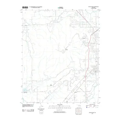
2010 Map of Poteau West
USGS Topo · Published 2010About this map
Cavanal Mountain and Wolf Mountain define the topography west of the Poteau valley in this 2010 study of Le Flore County. Smaller settlements such as Calhoun, Witteville, and Sorrels are documented alongside a network of country roads like Ogden Mills Trl and Bull Hill Rd. The landscape is a mix of high ridges and water-rich lowlands, featuring the Poteau River in the northeast corner and the significant Terrell Lake to the south. Local heritage is preserved through the mapping of the Oakland Cemetery and various family-named landmarks like Terry Hill. The inclusion of the Wolf Mountain Airport and the Caston Mountain Creek Site 5 Dam reflects modern infrastructure development within this traditional ranching and timber region of eastern Oklahoma.
Find a feature on this map
61 named features on this map. Tap any name to fly to it.
Don’t see what you’re looking for? This feature index may not catch every label — zoom into the map to look around manually.
Map Details
Editions of this 2010 Poteau West Map
This is the sole edition of this map. No revisions or reprints were ever made.
Other maps of this area

1900 · Sallisaw
USGS Topo · 1:125,000

1900 · Winding Stair
USGS Topo · 1:125,000

1909 · Winding Stair
USGS Topo · 1:125,000

1911 · Sallisaw
USGS Topo · 1:125,000

1946 · Fort Smith
USGS Topo · 1:250,000

1950 · Mcalester
USGS Topo · 1:250,000

1959 · Heavener
USGS Topo · 1:62,500

1962 · McAlester
USGS Topo · 1:250,000

1965 · Fort Smith
USGS Topo · 1:250,000

1965 · McAlester
USGS Topo · 1:250,000