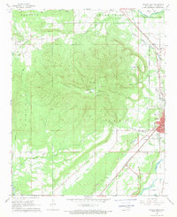
1968 Map of Poteau West
USGS Topo · Published 1969About this map
Cavanal Mountain dominates this landscape, its massive relief rising sharply above the western edge of Poteau and the surrounding valley. In the late 1960s, the area reflects a transition between traditional extractive industries and a growing regional center. Numerous Strip Mines and a Shale Pit are scattered along the flanks of the mountains and the valley floor, particularly near Witteville and the eastern slopes, marking the long history of coal mining in the Le Flore region.
Find a feature on this map
47 named features on this map. Tap any name to fly to it.
Don’t see what you’re looking for? This feature index may not catch every label — zoom into the map to look around manually.
Map Details
Editions of this 1968 Poteau West Map
3 editions found
Other maps of this area

1900 · Sallisaw
USGS Topo · 1:125,000

1900 · Winding Stair
USGS Topo · 1:125,000

1909 · Winding Stair
USGS Topo · 1:125,000

1911 · Sallisaw
USGS Topo · 1:125,000

1946 · Fort Smith
USGS Topo · 1:250,000

1950 · Mcalester
USGS Topo · 1:250,000

1959 · Heavener
USGS Topo · 1:62,500

1962 · McAlester
USGS Topo · 1:250,000

1965 · Fort Smith
USGS Topo · 1:250,000

1965 · McAlester
USGS Topo · 1:250,000