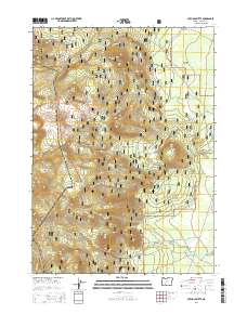
2014 Map of Pothole Butte
USGS Topo · Published 2014About this map
Crater Lake National Park and Winema National Forest dominate this high-elevation landscape in Klamath County, where volcanic peaks and desert flats converge. The terrain is defined by prominent rises such as Pothole Butte, Lookout Butte, and Bear Butte, which overlook the expansive Antelope Desert to the northeast. Water management in this arid environment is evidenced by Sand Cr Canal and the presence of dedicated infrastructure like Cistern No 29 and Cistern No 23. A complex network of Forest Service roads, including Nat For Dev Rd 2313 and Sun Mountain Rd, provides the primary access through these timbered lands. Small water sources like Pothole Spring and seasonal drainages such as Pothole Cr and Scott Cr underscore the region's sparse but critical hydrology.
Find a feature on this map
36 named features on this map. Tap any name to fly to it.
Don’t see what you’re looking for? This feature index may not catch every label — zoom into the map to look around manually.
Map Details
Editions of this 2014 Pothole Butte Map
This is the sole edition of this map. No revisions or reprints were ever made.
Other maps of this area

1889 · Klamath
USGS Topo · 1:250,000

1891 · Ashland
USGS Topo · 1:250,000

1893 · Ashland
USGS Topo · 1:250,000

1894 · Klamath
USGS Topo · 1:250,000

1897 · Ashland
USGS Topo · 1:250,000

1917 · Diamond Lake
USGS Topo · 1:125,000

1935 · Chemult
USGS Topo · 1:96,000

1941 · Chemult
USGS Topo · 1:125,000

1955 · Crescent
USGS Topo · 1:250,000

1955 · Klamath Falls
USGS Topo · 1:250,000