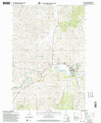
1994 Map of Potlatch
USGS Topo · Published 1997About this map
The Palouse River valley serves as the central corridor for this North Idaho landscape, where the town of Potlatch and neighboring Onaway developed as key logging and transport hubs. Revised from earlier aerial surveys by the Forest Service, the map highlights the infrastructure of the timber era, including the Northern and Burlington rail lines that follow the river's bend. This period shows a transition in land use, marked by industrial features like the Sewage Disposal Ponds and a Gravel Pit alongside traditional rural landmarks such as a high-altitude Cem and family-named points like Farber Point. From the forested slopes of Ball Butte to the specialized facilities at the Palouse Ranger Station, the map captures the community's dependence on the surrounding timberlands and the winding waters of Deep Creek and Flannigan Creek.
Find a feature on this map
30 named features on this map. Tap any name to fly to it.
Don’t see what you’re looking for? This feature index may not catch every label — zoom into the map to look around manually.
Map Details
Editions of this 1994 Potlatch Map
2 editions found
Other maps of this area

1903 · Oakesdale
USGS Topo · 1:125,000

1905 · Oakesdale
USGS Topo · 1:125,000

1910 · Pullman
USGS Topo · 1:125,000

1955 · Pullman
USGS Topo · 1:250,000

1955 · Spokane
USGS Topo · 1:250,000

1957 · Tensed
USGS Topo · 1:62,500

1958 · Spokane
USGS Topo · 1:250,000

1958 · Pullman
USGS Topo · 1:250,000

1960 · Robinson Lake
USGS Topo · 1:24,000

1960 · Moscow Mtn
USGS Topo · 1:24,000