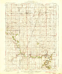
1936 Map of Potomac
USGS Topo · Published 1936About this map
The Middle Fork Vermilion River carves a winding path through the central Illinois prairie, anchoring a landscape defined by its rural township structure in the early 1930s. Centered on the village of Potomac, the map illustrates a network of small agricultural hubs like Rankin, Armstrong, and Penfield, each connected by the intersecting lines of the New York Chicago and St. Louis RR and the Illinois Central RR.
Find a feature on this map
79 named features on this map. Tap any name to fly to it.
Don’t see what you’re looking for? This feature index may not catch every label — zoom into the map to look around manually.
Map Details
Editions of this 1936 Potomac Map
3 editions found
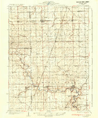
Other maps of this area

1899 · Danville
USGS Topo · 1:62,500

1900 · Danville
USGS Topo · 1:62,500

1906 · Urbana
USGS Topo · 1:62,500

1924 · Paxton
USGS Topo · 1:62,500

1927 · Paxton
USGS Topo · 1:62,500

1931 · Fithian
USGS Topo · 1:48,000

1933 · Hoopeston
USGS Topo · 1:48,000

1936 · Potomac
USGS Topo · 1:62,500

1938 · Milford
USGS Topo · 1:48,000

1938 · Hoopeston
USGS Topo · 1:62,500