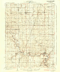
1936 Map of Potomac
USGS Topo · Published 1936About this map
The Middle Fork Vermilion River meanders through this portion of east-central Illinois, anchoring a landscape of established townships like Butler, Middle Fork, and Compromise. Surveyed in the early 1930s, the map reveals a dense network of rural infrastructure, including a remarkably high concentration of country schoolhouses such as Science Hill Sch, Judy Sch, and Gordon Sch. These landmarks, alongside the New York Chicago and St Louis RR passing through Rankin, reflect a mature agricultural society organized around small rail towns and local school districts.
Find a feature on this map
71 named features on this map. Tap any name to fly to it.
Don’t see what you’re looking for? This feature index may not catch every label — zoom into the map to look around manually.
Map Details
Editions of this 1936 Potomac Map
3 editions found
Other maps of this area

1899 · Danville
USGS Topo · 1:62,500

1900 · Danville
USGS Topo · 1:62,500

1906 · Urbana
USGS Topo · 1:62,500

1924 · Paxton
USGS Topo · 1:62,500

1927 · Paxton
USGS Topo · 1:62,500

1931 · Fithian
USGS Topo · 1:48,000

1933 · Hoopeston
USGS Topo · 1:48,000

1936 · Potomac
USGS Topo · 1:62,500

1938 · Milford
USGS Topo · 1:48,000

1938 · Hoopeston
USGS Topo · 1:62,500