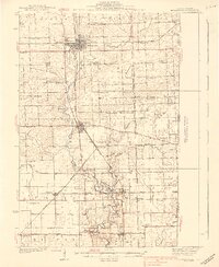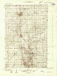
1933 Map of Hoopeston
USGS Topo · Published 1933About this map
Hoopeston serves as the major industrial and rail hub of this rural landscape during the early 1930s, situated at the intersection of the New York Chicago and St Louis RR and the Chicago and Eastern Illinois RR. The map reveals a high density of one-room country schools, such as Cunningham Sch, Goldsberry Sch, and Pond Sch, reflecting the township-based educational system before school consolidation. These local landmarks, along with places of worship like Antioch Ch and Manns Chapel, provide essential reference points for genealogists tracing family locations in northern Vermilion County.
Find a feature on this map
64 named features on this map. Tap any name to fly to it.
Don’t see what you’re looking for? This feature index may not catch every label — zoom into the map to look around manually.
Map Details
Editions of this 1933 Hoopeston Map
This is the sole edition of this map. No revisions or reprints were ever made.
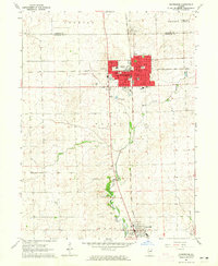
Historical Maps of Hoopeston Through Time
8 maps found