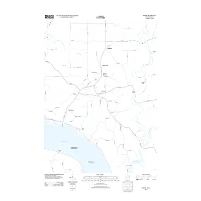
2013 Map of Potosi
USGS Topo · Published 2013About this map
The Mississippi River shoreline and its rugged bluff-side settlements define this corner of Grant County, where the historic lead-mining region transitions to the river's edge. The interconnected villages of Potosi and Tennyson serve as central hubs, linked by Us-61 as it winds through the interior. A complex network of drainage and terrain is evident in the numerous namesake hollows, including British Hollow, Yankee Hollow, and Hog Hollow, which channel water toward Potosi Cr and the larger river system. Along the eastern edge, the Platte River and Little Platte River converge, crossed by landmarks like Steinback Bridge and Banfield Bridge. Further north, smaller hamlets like Rockville and Buena Vista are scattered among the ridges, while the riverfront itself is marked by significant navigational features such as Island Number Two Hundred Eleven and the historic crossing at Spechts Ferry.
Find a feature on this map
79 named features on this map. Tap any name to fly to it.
Don’t see what you’re looking for? This feature index may not catch every label — zoom into the map to look around manually.
Map Details
Editions of this 2013 Potosi Map
This is the sole edition of this map. No revisions or reprints were ever made.
Other maps of this area

1900 · Lancaster
USGS Topo · 1:125,000

1904 · Lancaster
USGS Topo · 1:125,000

1908 · Lancaster
USGS Topo · 1:125,000

1955 · Balltown
USGS Topo · 1:24,000

1956 · Dubuque North
USGS Topo · 1:24,000

1956 · Sherrill
USGS Topo · 1:24,000

1957 · Potosi
USGS Topo · 1:24,000

1959 · Dubuque
USGS Topo · 1:250,000

1961 · Dubuque
USGS Topo · 1:250,000
1961 · Dickeyville
USGS Topo · 1:24,000